Ohio has three major metro markets — Columbus, Cleveland, and Cincinnati — each with its own field service geography and demand profile. Columbus is the fastest-growing large city in the Midwest, Cleveland's industrial communities generate dense commercial service demand, and Cincinnati's tri-state market crosses into Kentucky and Indiana. GPS fleet tracking gives Ohio contractors real-time visibility across all three markets.
Columbus metro traffic on I-270, I-71, and I-70 creates 30–50 minute dispatch delays during peak hours. Cleveland's I-480, I-77, and I-90 corridors see similar congestion across Cuyahoga, Summit, and Lake counties. Without GPS tracking, Ohio service companies route techs across three major metro areas without live location data.
ServiceBridge GPS fleet tracking gives Ohio businesses live fleet visibility from Columbus to Cleveland, Cincinnati, and the Ohio River Valley — enabling efficient dispatch across a state with three economically productive metro markets and a large rural mid-state service territory.
As part of the GPS Fleet Tracking Software platform, Ohio businesses get enterprise-grade GPS fleet management paired with full field service software — scheduling, dispatch, invoicing, and driver coaching — all in one place.
HVACPlumbingElectricalRoofingPest Control
What You Get
GPS Fleet Tracking Ohio — What ServiceBridge Delivers
Here’s exactly what Ohio field service companies get when they combine ServiceBridge GPS fleet tracking with field service management software:
Real-time GPS tracking for Columbus metro fleets on I-270, I-71, and I-70
Cleveland metro route optimization on I-480, I-77, and I-90 across Cuyahoga and Summit counties
Cincinnati tri-state dispatch across Hamilton County, OH and Northern Kentucky
Ohio winter emergency surge coordination for Cleveland lake-effect and central Ohio cold snaps
Geofence alerts for job sites across all 88 Ohio counties
Digital invoicing for on-site payment across Ohio residential, commercial, and industrial accounts
Sound Familiar?
The Challenges Hurting Ohio Field Service Businesses
❌ Columbus I-270 outer belt dispatch chaos
HVAC and plumbing companies serving Delaware, Licking, and Pickaway counties send techs around the I-270 outer belt without GPS, while closer trucks are already on the right side of Columbus.
❌ Cleveland industrial corridor density
Commercial service companies covering the I-77 and I-480 industrial corridors in Cuyahoga and Summit counties need precise job arrival documentation for manufacturing and warehousing accounts.
❌ Cincinnati tri-state complexity
Ohio service companies serving Butler, Warren, and Hamilton counties alongside Northern Kentucky accounts need a single GPS platform that covers both sides of the Ohio River.
❌ Ohio winter emergency surges
Cleveland and Toledo's lake-effect snow events create simultaneous HVAC and pipe-freeze emergencies across hundreds of Ohio communities, requiring rapid GPS-coordinated fleet response.
Field + Fleet Integration
One Platform for Every Vehicle and Every Job in Ohio
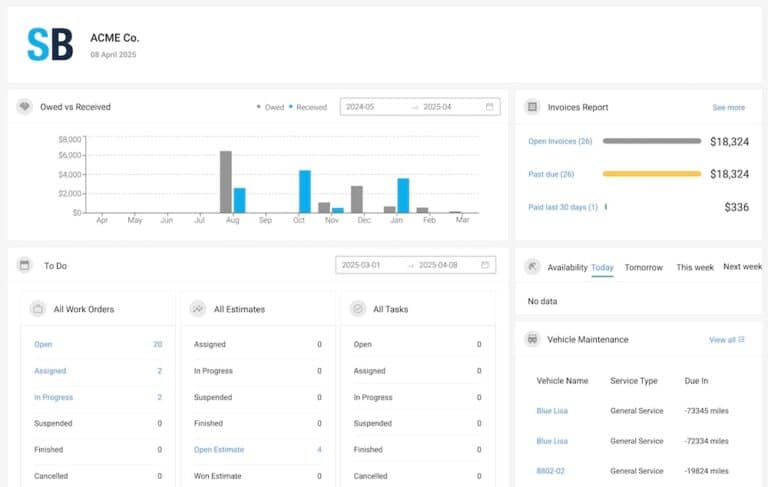
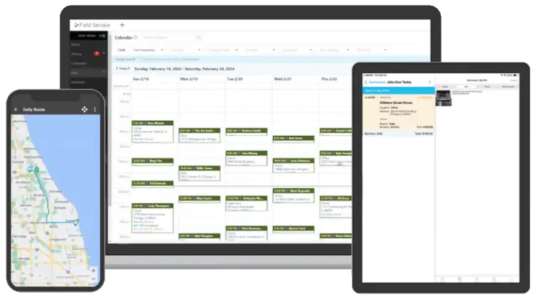
ServiceBridge combines GPS fleet tracking Ohio with full field service management — so your dispatcher can see every vehicle on a live map, assign jobs, send automated ETAs, and process invoices all from a single screen.
Live map showing every tech across Ohio and surrounding areas
Automated customer notifications with real-time ETAs
Digital invoicing — get paid on-site, not 30 days later
Driver coaching alerts for unsafe behavior on Ohio roads
Preventive maintenance scheduling to keep your Ohio fleet road-ready
Fleet Visibility
Know Where Every Vehicle Is — Right Now
Ohio field service managers using ServiceBridge get complete real-time visibility into their entire fleet. Ohio — 11.8M+ residents, 88 counties, with Columbus the 14th largest US city and one of the fastest-growing Midwest metros
Real-time GPS position updated every 30 seconds
Route history replay for any vehicle, any date
Geofence alerts when vehicles enter or leave job sites
Idle time tracking to reduce fuel waste
After-hours usage alerts to prevent unauthorized vehicle use
What Ohio field service businesses ask before switching to ServiceBridge + GPS Insight.
Is there GPS fleet tracking software near me in Ohio?
Yes. ServiceBridge GPS fleet tracking software serves field service businesses throughout Ohio. Get real-time vehicle locations, driver behavior monitoring, and integrated dispatch — built for companies just like yours.
GPS fleet tracking software installs a small device in each vehicle that transmits real-time location to a cloud dashboard — updated every 30 seconds. For Ohio field service businesses, that means your dispatcher sees every technician on a live map, assigns the closest tech to new jobs, monitors driver behavior, and automatically logs time on-site. ServiceBridge combines GPS tracking with full field service management — scheduling, dispatch, invoicing, and customer notifications — in one platform built for home to one of the Midwest's largest field service markets with strong HVAC, plumbing, electrical, and roofing industries across Columbus, Cleveland, Cincinnati, and Ohio's industrial communities.
ServiceBridge GPS fleet tracking is priced per vehicle per month — no large upfront hardware costs — with plans for fleets of any size. Most Ohio businesses recover the full subscription cost within the first month through reduced fuel waste, fewer unauthorized vehicle uses, and faster invoice collection. Call (888) 586-8932 for a quote tailored to your Ohio fleet size.
Any Ohio field service business with multiple vehicles sees immediate ROI from GPS tracking — especially HVAC, Plumbing, Electrical, and similar trades. If your dispatcher needs to know where your techs are and your customers expect accurate ETAs, ServiceBridge delivers both.
Yes. ServiceBridge and GPS Insight use nationwide cellular networks to track vehicles anywhere in the Ohio service area — including routes into surrounding communities and rural territory. Tracking syncs automatically in lower-coverage areas. For businesses serving both Ohio and surrounding states, the platform gives your dispatcher a single unified view of your entire fleet.
Most Ohio businesses are fully live within one business day of receiving hardware. The GPS devices plug into each vehicle’s OBD-II port — no professional installation needed. Most dispatchers are routing and tracking their Ohio fleet within the first hour. A dedicated onboarding team provides setup support at no extra cost.
ServiceBridge GPS tracking reduces costs for Ohio businesses in five key ways: (1) route optimization cuts fuel spend, (2) idle-time alerts eliminate engine-running downtime, (3) preventive maintenance scheduling prevents costly emergency repairs, (4) driver coaching reduces accident liability, and (5) automated invoicing accelerates cash flow so you’re not waiting 30 days to get paid.
Expand Your Reach
GPS Fleet Tracking by City in Ohio
ServiceBridge covers every market in Ohio. Click your city for a dedicated GPS fleet tracking page.